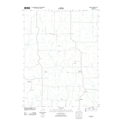
2012 Map of Winigan
USGS Topo · Published 2012About this map
Winigan and North Salem anchor this rural landscape in Linn County, where small agricultural hubs are connected by a network of local routes like Winigan Rd and Wichita Rd. The terrain is defined by the branching waterways of East Yellow Creek, Winigan Creek, and Mussel Fork, which shape the placement of historic farmsteads and rural infrastructure. A significant concentration of family and community burial grounds, including Bunch Cemetery, Pickerel Cemetery, and McCollum Cemetery, underscores the deep genealogical roots of the area. Further south, the community of Sedgwick is noted by the Sedgwick Post Office, while the Brantner Lake Dam indicates local water management efforts. This survey captures a quiet, established farming region where the drainage patterns of creeks like John Branch and Bull Branch remain the primary geographical influence on settlement.
Find a feature on this map
52 named features on this map. Tap any name to fly to it.
Don’t see what you’re looking for? This feature index may not catch every label — zoom into the map to look around manually.
Map Details
Editions of this 2012 Winigan Map
This is the sole edition of this map. No revisions or reprints were ever made.
Other maps of this area

1946 · Brookfield
USGS Topo · 1:62,500

1948 · Brookfield
USGS Topo · 1:62,500

1949 · Bucklin NW
USGS Topo · 1:24,000

1950 · Bucklin NW
USGS Topo · 1:24,000

1951 · New Boston
USGS Topo · 1:24,000

1953 · Moberly
USGS Topo · 1:250,000

1954 · Centerville
USGS Topo · 1:250,000

1954 · Moberly
USGS Topo · 1:250,000

1957 · Moberly
USGS Topo · 1:250,000

1957 · Centerville
USGS Topo · 1:250,000