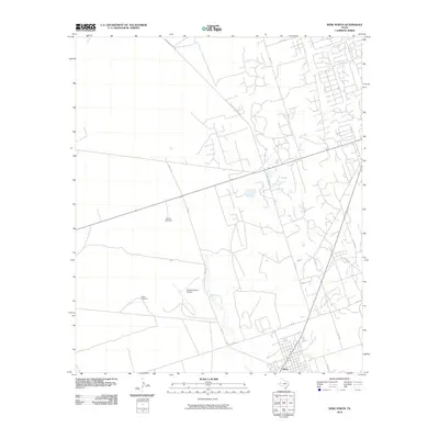
2010 Map of Wink North
USGS Topo · Published 2010About this map
The northern limits of Wink and the surrounding West Texas oil fields define this 2010 landscape. The settlement pattern is dominated by a dense grid of service roads and industrial access points, including Co Rd 105 and Frying Pan Ranch Rd, reflecting the region's long-standing connection to resource extraction. Infrastructure like the Winkler County Airport and a series of rural routes such as Fm 1232 and Fm 874 connect the sparse residential areas to the broader Permian Basin. Named landmarks like Canyon Windmill and Baldy Windmill stand as practical markers in an arid environment, where water security was traditionally the primary concern for ranchers. This survey documents the modern intersection of traditional ranching heritage and the technical demands of the energy industry north of the town center.
Find a feature on this map
16 named features on this map. Tap any name to fly to it.
Don’t see what you’re looking for? This feature index may not catch every label — zoom into the map to look around manually.
Map Details
Editions of this 2010 Wink North Map
This is the sole edition of this map. No revisions or reprints were ever made.
Other maps of this area

1954 · Pecos
USGS Topo · 1:250,000

1957 · Pecos
USGS Topo · 1:250,000

1968 · Wink South
USGS Topo · 1:24,000

1968 · Soda Lake NE
USGS Topo · 1:24,000

1969 · Pyote NE
USGS Topo · 1:24,000

1970 · Cheyenne Draw
USGS Topo · 1:24,000

1970 · Wink North
USGS Topo · 1:24,000

1970 · Cheyenne Draw SE
USGS Topo · 1:24,000

1970 · Vesrue
USGS Topo · 1:24,000

1970 · Kermit NW
USGS Topo · 1:24,000