
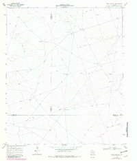
1968 Map of Soda Lake NE
USGS Topo · Published 1971About this map
Water and oil infrastructure define this arid landscape in the late 1960s, where three counties — Loving, Ward, and Winkler — meet. The arid terrain is crisscrossed by a network of Jeep Trails, providing access to critical water sources such as the Bachelor Windmill, China Windmill, and Windmill No 4. These landmarks were essential for cattle ranching in a region where an Indefinite Boundary reflects the shifting nature of the local surveys.
Find a feature on this map
17 named features on this map. Tap any name to fly to it.
Don’t see what you’re looking for? This feature index may not catch every label — zoom into the map to look around manually.
Map Details
Editions of this 1968 Soda Lake NE Map
2 editions found
Other maps of this area

1954 · Pecos
USGS Topo · 1:250,000

1957 · Pecos
USGS Topo · 1:250,000

1961 · Soda Lake
USGS Topo · 1:24,000

1967 · Soda Lake NW
USGS Topo · 1:24,000

1968 · Soda Lake SE
USGS Topo · 1:24,000

1968 · Wink South
USGS Topo · 1:24,000
1969 · Pyote West
USGS Topo · 1:24,000

1969 · Cheyenne Draw SW
USGS Topo · 1:24,000

1970 · Wink North
USGS Topo · 1:24,000

1970 · Cheyenne Draw SE
USGS Topo · 1:24,000