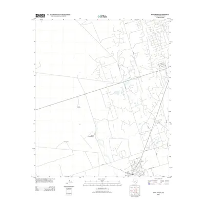
2012 Map of Wink North
USGS Topo · Published 2012About this map
Wink anchors the southern edge of this West Texas landscape, where the residential street grid gives way to a sprawling network of county roads and ranching infrastructure. The town's layout is defined by major thoroughfares such as S Kermit Ave and N Pyote Ave, while the surrounding Permian Basin terrain is dotted with vital water sources and aviation hubs. The Winkler County Airport and its accompanying Airfield Rd represent the area's logistical importance, serving the nearby energy and ranching sectors. Further north, the vast open reaches are marked by specific landmarks like Canyon Windmill and Baldy Windmill, which signify the enduring agricultural use of the land. The presence of Frying Pan Ranch Rd highlights the region's historic ranching heritage, providing a clear view of the rural development patterns in Winkler County during the early 21st century.
Find a feature on this map
37 named features on this map. Tap any name to fly to it.
Don’t see what you’re looking for? This feature index may not catch every label — zoom into the map to look around manually.
Map Details
Editions of this 2012 Wink North Map
This is the sole edition of this map. No revisions or reprints were ever made.
Other maps of this area

1954 · Pecos
USGS Topo · 1:250,000

1957 · Pecos
USGS Topo · 1:250,000

1968 · Wink South
USGS Topo · 1:24,000

1968 · Soda Lake NE
USGS Topo · 1:24,000

1969 · Pyote NE
USGS Topo · 1:24,000

1970 · Cheyenne Draw
USGS Topo · 1:24,000

1970 · Wink North
USGS Topo · 1:24,000

1970 · Cheyenne Draw SE
USGS Topo · 1:24,000

1970 · Vesrue
USGS Topo · 1:24,000

1970 · Kermit NW
USGS Topo · 1:24,000