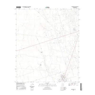
2016 Map of Wink North
USGS Topo · Published 2016About this map
Wink anchors the southern edge of this West Texas landscape, where the town's residential grid meets the industrial and aviation infrastructure of the Permian Basin. Local street names pay homage to the area's cultural history, including Ray Orbison Dr, which sits near the intersection of N Monahans Dr and NW Bonnie Way. The Winkler County Airport occupies a significant portion of the central terrain, situated just west of FM 1232. The landscape is further defined by the seasonal path of Monument Draw, which meanders through the arid plains. To the north, a complex network of oil field access roads and county routes, such as Co RD 101 and Co RD 105, indicates the area's ongoing connection to energy production. Residential developments appear along the eastern edge with streets like W Campbell St and Kermit St, reflecting the growth of this desert community.
Find a feature on this map
36 named features on this map. Tap any name to fly to it.
Don’t see what you’re looking for? This feature index may not catch every label — zoom into the map to look around manually.
Map Details
Editions of this 2016 Wink North Map
This is the sole edition of this map. No revisions or reprints were ever made.
Other maps of this area

1954 · Pecos
USGS Topo · 1:250,000

1957 · Pecos
USGS Topo · 1:250,000

1968 · Wink South
USGS Topo · 1:24,000

1968 · Soda Lake NE
USGS Topo · 1:24,000

1969 · Pyote NE
USGS Topo · 1:24,000

1970 · Cheyenne Draw
USGS Topo · 1:24,000

1970 · Wink North
USGS Topo · 1:24,000

1970 · Cheyenne Draw SE
USGS Topo · 1:24,000

1970 · Vesrue
USGS Topo · 1:24,000

1970 · Kermit NW
USGS Topo · 1:24,000