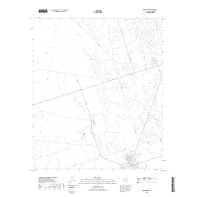
2019 Map of Wink North
USGS Topo · Published 2019About this map
Wink serves as the primary hub in this corner of the West Texas Permian Basin, where the town grid transitions into a landscape dominated by industrial and aviation infrastructure. The Winkler County Airport stands north of the settlement, its runways positioned near the banks of Monument Draw, a prominent natural drainage feature cutting through the terrain. The map detail reflects the region's late 20th-century development, particularly in the layout of residential streets such as NW Bonnie Way and Hendricks Blvd. North of the town center, a network of county roads like Co RD 101 and N FM 874 spider through the scrubland, marking the paths of local transport and utility access. This document provides a clear view of the town's expansion and its integration with the broader rural county road system.
Find a feature on this map
36 named features on this map. Tap any name to fly to it.
Don’t see what you’re looking for? This feature index may not catch every label — zoom into the map to look around manually.
Map Details
Editions of this 2019 Wink North Map
This is the sole edition of this map. No revisions or reprints were ever made.
Other maps of this area

1954 · Pecos
USGS Topo · 1:250,000

1957 · Pecos
USGS Topo · 1:250,000

1968 · Wink South
USGS Topo · 1:24,000

1968 · Soda Lake NE
USGS Topo · 1:24,000

1969 · Pyote NE
USGS Topo · 1:24,000

1970 · Cheyenne Draw
USGS Topo · 1:24,000

1970 · Wink North
USGS Topo · 1:24,000

1970 · Cheyenne Draw SE
USGS Topo · 1:24,000

1970 · Vesrue
USGS Topo · 1:24,000

1970 · Kermit NW
USGS Topo · 1:24,000