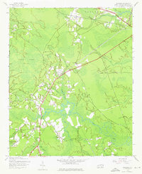
1943 Map of Winnabow
USGS Topo · Published 1976About this map
Town Creek and its many winding tributaries, including Rice Creek and Mallory Creek, dominate this coastal North Carolina landscape. At the time of this 1943 survey, the area was characterized by small agricultural settlements and rural infrastructure, including the Bell Swamp Sch and the Wayside Ch near Winnabow. The map reveals the early 20th-century transportation network, featuring an Abandoned Railroad Grade that cuts across the terrain toward Lanvale. Family history is rooted in landmarks like Benton Cem and Nelson Cem, while the expansive Little Green Swamp defines the western edge of the quadrangle. Other small communities such as Elijah, Spring Hill, and Henrytown appear connected by a mix of light-duty and unimproved roads, reflecting the slow pace of development in rural Northwest Brunswick County during the war years.
Find a feature on this map
34 named features on this map. Tap any name to fly to it.
Don’t see what you’re looking for? This feature index may not catch every label — zoom into the map to look around manually.
Map Details
Editions of this 1943 Winnabow Map
2 editions found
Other maps of this area

1942 · Wilmington
USGS Topo · 1:62,500

1943 · Funston
USGS Topo · 1:24,000

1943 · Winnabow
USGS Topo · 1:24,000

1943 · Bolivia
USGS Topo · 1:24,000

1943 · Lewis Swamp
USGS Topo · 1:24,000

1944 · Bolivia
USGS Topo · 1:31,680

1944 · Winnabow
USGS Topo · 1:31,680

1944 · Lewis Swamp
USGS Topo · 1:31,680

1947 · Rocky Point
USGS Topo · 1:62,500

1948 · Wilmington
USGS Topo · 1:62,500