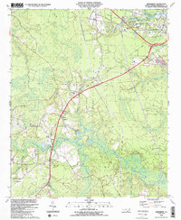
1990 Map of Winnabow
USGS Topo · Published 1991About this map
The blackwater systems of Rice Creek and Town Creek dominate this coastal plain landscape near the Navassa Corporate Boundary. Mapping from the late 1980s reveals a region defined by its wetlands, such as Beaverdam Swamp and Bell Swamp, interspersed with small settlements and family-named land features. The distribution of spiritual and educational centers, including Damascus Rd Ch, Holy Convent Ch, and the Leland Sch, suggests a community structure tied to early crossroads and rail paths. An Old Railroad Grade and Old RR Grade cutting through the terrain point to former timber or freight corridors that once linked Leland to Spring Hill. This survey captures the transition of the area as it maintained its rural character while supporting industrial operations like the Sandpits near Woodburn.
Find a feature on this map
50 named features on this map. Tap any name to fly to it.
Don’t see what you’re looking for? This feature index may not catch every label — zoom into the map to look around manually.
Map Details
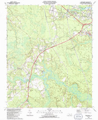
Editions of this 1990 Winnabow Map
2 editions found
Other maps of this area

1942 · Wilmington
USGS Topo · 1:62,500

1943 · Funston
USGS Topo · 1:24,000

1943 · Winnabow
USGS Topo · 1:24,000

1943 · Bolivia
USGS Topo · 1:24,000

1943 · Lewis Swamp
USGS Topo · 1:24,000

1944 · Bolivia
USGS Topo · 1:31,680

1944 · Winnabow
USGS Topo · 1:31,680

1944 · Lewis Swamp
USGS Topo · 1:31,680

1947 · Rocky Point
USGS Topo · 1:62,500

1948 · Wilmington
USGS Topo · 1:62,500