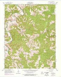
1954 Map of Winnipeg
USGS Topo · Published 1977About this map
Winnipeg and the surrounding rural landscape of Laclede County are defined by the winding course of the Gasconade River, which cuts through the central Missouri hills. This mid-century survey reveals a network of small community centers linked by creeks and hollows, including Nebo and Southard. The cultural landscape is rich with local history markers, from the Winnipeg Cem and McGinnis Cem to several country schools like Nebo School and the Morehouse School (abandoned). While much of the area is part of the Mark Twain National Forest, the eastern portion transitions into the Fort Leonard Wood Military Reservation. This map captures the transition from small-scale family farming and local timber use toward a landscape managed for conservation and military training, while still preserving the locations of Winnipeg Church and other community pillars.
Find a feature on this map
35 named features on this map. Tap any name to fly to it.
Don’t see what you’re looking for? This feature index may not catch every label — zoom into the map to look around manually.
Map Details
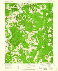
Editions of this 1954 Winnipeg Map
2 editions found
Other maps of this area

1931 · Manes
USGS Topo · 1:48,000

1941 · Big Piney
USGS Topo · 1:62,500

1941 · Manes
USGS Topo · 1:62,500

1941 · Bado
USGS Topo · 1:62,500

1943 · Big Piney
USGS Topo · 1:62,500

1943 · Manes
USGS Topo · 1:62,500

1943 · Drynob
USGS Topo · 1:62,500

1943 · Bado
USGS Topo · 1:62,500

1954 · Springfield
USGS Topo · 1:250,000

1954 · Drynob
USGS Topo · 1:62,500