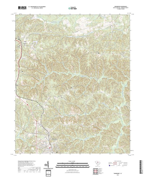
2024 Map of Winnsboro
USGS Topo · Published 2024About this map
Winnsboro stands as the primary seat of Fairfield County, anchored by the historic Fairfield County Courthouse and a dense network of residential streets like N Congress St and W Liberty St. The surrounding countryside is defined by the rolling drainage basins of Big Wateree Creek and Gaydens Creek, where the Wateree-Cr Watershed Structure Number Four regulates the local flow. To the north, the small settlement of White Oak is clustered near several long-standing burial grounds, including the White Oak Church Graveyard and Weeping Mary Church Cem. This landscape reveals a deep-seated genealogy, with numerous family and community cemeteries such as Bethlehem Cem, Cason Cem, and Mount Olivet Cem scattered across the rural tracts between Adger and the town center. The network of secondary roads, from Old River Rd to Mobley Hwy, connects these quiet upland farms to the regional hub of Winnsboro.
Find a feature on this map
67 named features on this map. Tap any name to fly to it.
Don’t see what you’re looking for? This feature index may not catch every label — zoom into the map to look around manually.
Map Details
Editions of this 2024 Winnsboro Map
This is the sole edition of this map. No revisions or reprints were ever made.
Other maps of this area

1904 · Columbia
USGS Topo · 1:125,000

1941 · Spartanburg
USGS Topo · 1:250,000

1942 · Camden
USGS Topo · 1:125,000

1953 · Spartanburg
USGS Topo · 1:250,000

1960 · Spartanburg
USGS Topo · 1:250,000

1963 · Spartanburg
USGS Topo · 1:250,000

1964 · Spartanburg
USGS Topo · 1:250,000

1968 · Blackstock
USGS Topo · 1:24,000
1969 · Great Falls
USGS Topo · 1:24,000

1969 · Lebanon
USGS Topo · 1:24,000