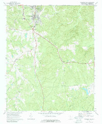
1969 Map of Winnsboro Mills
USGS Topo · Published 1989About this map
Winnsboro Mills and the railroad junction at Rockton anchor this Fairfield County landscape as it appeared in the late 1960s. The area's industrial and civic infrastructure is clearly marked, from the Winnsboro Filtration Plant and the nearby Fairfield Mem Hospital to the educational centers of Everett Sch and Winnsboro High Sch. The town's social fabric is visible in the distribution of its religious and community sites, including St Theresa Ch and the local Golf Course.
Find a feature on this map
38 named features on this map. Tap any name to fly to it.
Don’t see what you’re looking for? This feature index may not catch every label — zoom into the map to look around manually.
Map Details
Editions of this 1969 Winnsboro Mills Map
2 editions found
Other maps of this area

1904 · Columbia
USGS Topo · 1:125,000

1935 · Killian
USGS Topo · 1:48,000

1937 · Killian
USGS Topo · 1:62,500

1941 · Spartanburg
USGS Topo · 1:250,000

1942 · Camden
USGS Topo · 1:125,000

1947 · Richtex
USGS Topo · 1:24,000

1949 · Richtex
USGS Topo · 1:24,000

1949 · Irmo NE
USGS Topo · 1:24,000

1953 · Blythewood
USGS Topo · 1:24,000

1953 · Spartanburg
USGS Topo · 1:250,000