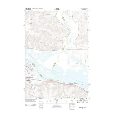
2013 Map of Winona East
USGS Topo · Published 2013About this map
The Mississippi River acts as the defining border between Minnesota and Wisconsin in this 2013 survey, framing the urban development of Winona against a complex network of backwaters and islands. On the Minnesota bank, the city's residential and educational infrastructure is evident at Morningside Terrace and the Minnesota State College-Southeast Technical campus, while Lake Winona and Gilmore Creek highlight the city's relationship with its aquatic surroundings. Across the water, East Winona represents the Wisconsin side of the river valley, where the terrain shifts toward more agricultural uses and rural cemeteries like Piper Valley Cem and Greenwood Cem. The geography is characterized by dramatic elevation changes south of the river, where Homer Valley, Decker Valley, and Homer Ridge rise steeply above the river plain, reflecting the unique driftless area topography that defines the Upper Mississippi region.
Find a feature on this map
93 named features on this map. Tap any name to fly to it.
Don’t see what you’re looking for? This feature index may not catch every label — zoom into the map to look around manually.
Map Details
Editions of this 2013 Winona East Map
This is the sole edition of this map. No revisions or reprints were ever made.
Other maps of this area

1929 · Fountain City
USGS Topo · 1:62,500

1929 · Galesville
USGS Topo · 1:62,500

1930 · La Crescent
USGS Topo · 1:62,500

1934 · Winona
USGS Topo · 1:62,500

1937 · Winona
USGS Topo · 1:62,500

1953 · Eau Claire
USGS Topo · 1:250,000

1956 · La Crescent
USGS Topo · 1:62,500

1958 · Eau Claire
USGS Topo · 1:250,000

1958 · Houston
USGS Topo · 1:62,500

1958 · La Crosse
USGS Topo · 1:250,000