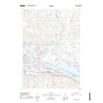
2019 Map of Winona East
USGS Topo · Published 2019About this map
The Mississippi River creates a complex boundary between Minnesota and Wisconsin on this 2019 survey, defining a landscape of braided channels and backwater islands. The riverfront area includes East Winona and the historic La Prairie aux Ailes district, where urban grid patterns meet the natural curves of Gilmore Cr and Mud Lake. Across the water, the Wisconsin side is marked by the Trempealeau River delta and engineering features like the Oxbow Dike and Kleps Island Dike.
Find a feature on this map
105 named features on this map. Tap any name to fly to it.
Don’t see what you’re looking for? This feature index may not catch every label — zoom into the map to look around manually.
Map Details
Editions of this 2019 Winona East Map
This is the sole edition of this map. No revisions or reprints were ever made.
Other maps of this area

1929 · Fountain City
USGS Topo · 1:62,500

1929 · Galesville
USGS Topo · 1:62,500

1930 · La Crescent
USGS Topo · 1:62,500

1934 · Winona
USGS Topo · 1:62,500

1937 · Winona
USGS Topo · 1:62,500

1953 · Eau Claire
USGS Topo · 1:250,000

1956 · La Crescent
USGS Topo · 1:62,500

1958 · Eau Claire
USGS Topo · 1:250,000

1958 · Houston
USGS Topo · 1:62,500

1958 · La Crosse
USGS Topo · 1:250,000