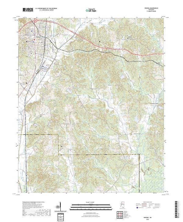
2024 Map of Winona
USGS Topo · Published 2024About this map
Winona serves as the focal point of this Montgomery County landscape, where the Montgomery County Courthouse anchors a street grid that includes Dr Martin Luther King Jr Blvd and Shirley Ave. This modern survey reveals a community deeply connected to its local heritage through numerous burial sites, including Oakwood Cem, Forrest Hill Cem, and the Winona Garden of Memory. The surrounding terrain is defined by the headwaters of the Big Black River and the complex drainage of the West Fork Lewis Creek and East Fork Lewis Creek.
Find a feature on this map
84 named features on this map. Tap any name to fly to it.
Don’t see what you’re looking for? This feature index may not catch every label — zoom into the map to look around manually.
Map Details
Editions of this 2024 Winona Map
This is the sole edition of this map. No revisions or reprints were ever made.
Other maps of this area

1953 · West Point
USGS Topo · 1:250,000

1954 · Duck Hill
USGS Topo · 1:62,500

1954 · McCarley
USGS Topo · 1:62,500

1958 · West Point
USGS Topo · 1:250,000

1963 · West Point
USGS Topo · 1:250,000

1966 · Kilmichael
USGS Topo · 1:24,000

1966 · Poplar Creek
USGS Topo · 1:24,000

1966 · Winona
USGS Topo · 1:24,000
1966 · Vaiden
USGS Topo · 1:24,000

1968 · Winona
USGS Topo · 1:62,500