
1914 Map of Winona
USGS Topo · Published 1914About this map
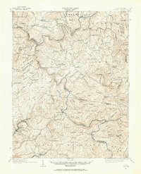
Sewell Mountain dominates the southern landscape of this 1914 survey, a region defined by the winding course of the Gauley River and Meadow River. This era in the central West Virginia highlands shows a transition from isolated mountain settlements to industrial activity, evidenced by the presence of the Lumber R. R. navigating the river bends near Corliss School. The map is exceptionally dense with rural infrastructure, documenting dozens of neighborhood schoolhouses such as Carnefix School, Backus School, and Oak Hill School. River crossings were vital to local commerce, with Carnefix Ferry, Raders Ford, and Hughes Ferry Bridge providing essential links between the townships of Jefferson, Grant, and Wilderness. The topography is marked by named ridges and knobs like Daubenspeck Knob and Bearhole Ridge, illustrating the challenging terrain that shaped early transportation routes through places like Russellville and Winona.
Find a feature on this map
139 named features on this map. Tap any name to fly to it.
Don’t see what you’re looking for? This feature index may not catch every label — zoom into the map to look around manually.
Map Details
Editions of this 1914 Winona Map
2 editions found
Other maps of this area

1887 · Hinton
USGS Topo · 1:125,000

1889 · Nicholas
USGS Topo · 1:125,000

1891 · Nicholas
USGS Topo · 1:125,000

1891 · Raleigh
USGS Topo · 1:125,000

1892 · Hinton
USGS Topo · 1:125,000

1897 · Kanawha Falls
USGS Topo · 1:125,000

1897 · Raleigh
USGS Topo · 1:125,000

1900 · Kanawha Falls
USGS Topo · 1:125,000

1901 · Nicholas
USGS Topo · 1:125,000

1901 · Kanawha Falls
USGS Topo · 1:125,000