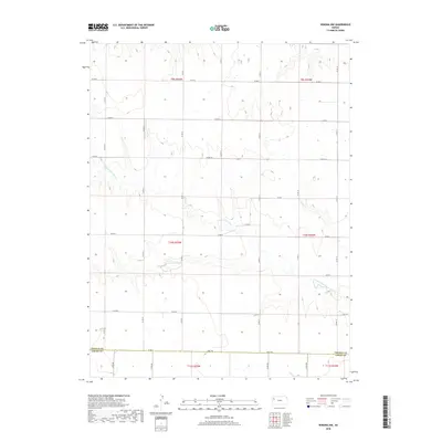
2018 Map of Winona NW
USGS Topo · Published 2018About this map
The S Fork Saline River cuts through this high-plains landscape in northwestern Kansas, where the rolling geography of the Smoky Hills region meets the open rangeland of the High Plains. This 2018 survey documents a quiet, primarily agricultural interior defined by the straight lines of section roads and the meandering drainage of the river. The southern border of this quadrangle tracks the county line between Thomas Co Logan Co, a region historically known for its fossil-rich geology and large-scale ranching operations. Significant landmarks include the terrain feature Fort Fox and a meticulous network of rural infrastructure, ranging from Co Rd A at the southern boundary to Co Rd H in the north. This map serves as a precise modern record of the land use and drainage patterns that have shaped this portion of the Saline River valley for generations.
Find a feature on this map
19 named features on this map. Tap any name to fly to it.
Don’t see what you’re looking for? This feature index may not catch every label — zoom into the map to look around manually.
Map Details
Editions of this 2018 Winona NW Map
This is the sole edition of this map. No revisions or reprints were ever made.
Other maps of this area

1943 · Colby
USGS Topo · 1:62,500

1954 · Goodland
USGS Topo · 1:250,000

1956 · Goodland
USGS Topo · 1:250,000

1957 · Goodland
USGS Topo · 1:250,000

1966 · Brewster SE
USGS Topo · 1:24,000

1967 · Colby SE
USGS Topo · 1:24,000

1967 · Colby SW
USGS Topo · 1:24,000

1969 · Mc Allaster SE
USGS Topo · 1:24,000

1969 · Mc Allaster NE
USGS Topo · 1:24,000

1972 · Monument
USGS Topo · 1:24,000