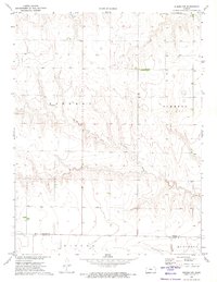
1972 Map of Winona NW
USGS Topo · Published 1974About this map
The South Fork Saline River meanders across this High Plains landscape, revealing the drainage patterns that define the border between Thomas Co and Logan Co. This 1972 survey documents a sparsely settled agricultural region dominated by large township divisions like Kingery and Summers. The presence of several Wells and a Gravel Pit near the river indicates the primary local industries of water management and road material extraction. In the northern section, the S Fk Solomon R cuts through the terrain, while the southern margin captures the outskirts of Winona and Monument. The map is particularly useful for understanding the exact placement of property lines and rural infrastructure just before the further expansion of interstate connectivity in the early 1970s.
Find a feature on this map
10 named features on this map. Tap any name to fly to it.
Don’t see what you’re looking for? This feature index may not catch every label — zoom into the map to look around manually.
Map Details
Editions of this 1972 Winona NW Map
This is the sole edition of this map. No revisions or reprints were ever made.
Other maps of this area

1943 · Colby
USGS Topo · 1:62,500

1954 · Goodland
USGS Topo · 1:250,000

1956 · Goodland
USGS Topo · 1:250,000

1957 · Goodland
USGS Topo · 1:250,000

1966 · Brewster SE
USGS Topo · 1:24,000

1967 · Colby SE
USGS Topo · 1:24,000

1967 · Colby SW
USGS Topo · 1:24,000

1969 · Mc Allaster SE
USGS Topo · 1:24,000

1969 · Mc Allaster NE
USGS Topo · 1:24,000

1972 · Monument
USGS Topo · 1:24,000