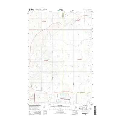
2014 Map of Winona South
USGS Topo · Published 2014About this map
Winona sits at the northern edge of this Upper Peninsula landscape, a settlement historically defined by the copper mining industry of the Copper Range. The terrain is marked by a complex network of waterways, including the E Br Firesteel River and the W Br Otter River, which carve through the heavily forested sections of the Ottawa National Forest. Genealogists and local historians can locate the Woodland Cem near Cemetery Lake, while the presence of Old Railroad Rd suggests the paths of former rail lines that once served the region's mineral interests. To the south, numerous small bodies of water like Courtney Lake, Sixmile Lake, and Butterfield Lake dot the basin, illustrating the glacial character of the Michigan backcountry.
Find a feature on this map
40 named features on this map. Tap any name to fly to it.
Don’t see what you’re looking for? This feature index may not catch every label — zoom into the map to look around manually.
Map Details
Editions of this 2014 Winona South Map
This is the sole edition of this map. No revisions or reprints were ever made.
Other maps of this area

1949 · Rockland
USGS Topo · 1:62,500

1950 · Greenland
USGS Topo · 1:62,500

1951 · Rockland
USGS Topo · 1:62,500

1951 · Greenland
USGS Topo · 1:62,500

1954 · Rousseau
USGS Topo · 1:62,500

1954 · Winona
USGS Topo · 1:62,500

1958 · Iron River
USGS Topo · 1:250,000

1960 · Iron River
USGS Topo · 1:250,000

1961 · Iron River
USGS Topo · 1:250,000

1967 · Iron River
USGS Topo · 1:250,000