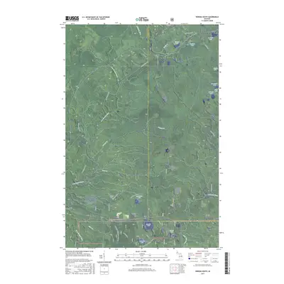
2017 Map of Winona South
USGS Topo · Published 2017About this map
The settlement of Winona anchor this landscape along the Houghton and Ontonagon county line in the western Upper Peninsula. This 2017 survey shows a region defined by its timber and rail heritage, notably through the Bill Nicholls Route and an extensive Old Railroad Grade that cut through the heavy forest. Local history is centered around the Woodland Cem and Winona Lake, while the southern portion of the map is dedicated to public lands and recreation within the Ottawa National Forest. Researchers will find a water-rich environment featuring Sixmile Lake, Courtney Lake, and the winding E Br Firesteel River. The Ontonagon Equestrian Complex and the Six-Mile Lake Interpretive trail reflect the modern recreational use of this former industrial landscape.
Find a feature on this map
44 named features on this map. Tap any name to fly to it.
Don’t see what you’re looking for? This feature index may not catch every label — zoom into the map to look around manually.
Map Details
Editions of this 2017 Winona South Map
This is the sole edition of this map. No revisions or reprints were ever made.
Other maps of this area

1949 · Rockland
USGS Topo · 1:62,500

1950 · Greenland
USGS Topo · 1:62,500

1951 · Rockland
USGS Topo · 1:62,500

1951 · Greenland
USGS Topo · 1:62,500

1954 · Rousseau
USGS Topo · 1:62,500

1954 · Winona
USGS Topo · 1:62,500

1958 · Iron River
USGS Topo · 1:250,000

1960 · Iron River
USGS Topo · 1:250,000

1961 · Iron River
USGS Topo · 1:250,000

1967 · Iron River
USGS Topo · 1:250,000