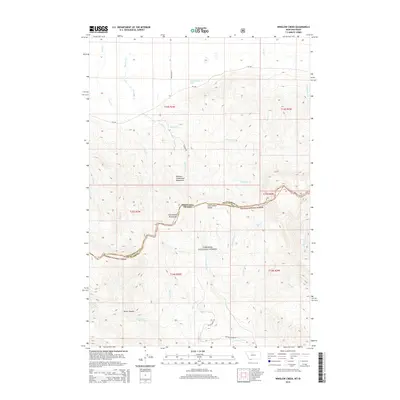
2014 Map of Winslow Creek
USGS Topo · Published 2014About this map
The Continental Divide serves as the literal and topographic backbone of this high-altitude landscape, marking the border between Montana and Idaho. Situated within the Western Centennial Mountains, the terrain transitions from the high peaks of the Centennial Mountains into the protected timberlands of the Targhee National Forest. This 2014 survey captures a wilderness dominated by complex drainage systems, where water flows from the heights via Winslow Cr and Tipton Cr toward the lower valleys. The southern portion of the map is defined by deep incisions like Burnt Canyon and the headwaters of numerous small creeks such as Coon Cr and Salamander Cr. Human presence is minimal, represented primarily by forestry and access routes including Ragged Rd and Brundage Ln, reflecting the area's role as a vital corridor for wildlife and a managed resource for the Forest Service.
Find a feature on this map
36 named features on this map. Tap any name to fly to it.
Don’t see what you’re looking for? This feature index may not catch every label — zoom into the map to look around manually.
Map Details
Editions of this 2014 Winslow Creek Map
This is the sole edition of this map. No revisions or reprints were ever made.
Other maps of this area

1950 · Lower Red Rock Lake
USGS Topo · 1:62,500

1955 · Dubois
USGS Topo · 1:250,000

1955 · Ashton
USGS Topo · 1:250,000

1958 · Dubois
USGS Topo · 1:250,000

1958 · Ashton
USGS Topo · 1:250,000

1960 · Ashton
USGS Topo · 1:250,000

1968 · Big Table Mountain
USGS Topo · 1:24,000

1968 · Antelope Peak
USGS Topo · 1:24,000

1972 · Antelope Valley
USGS Topo · 1:24,000

1972 · Kilgore
USGS Topo · 1:24,000