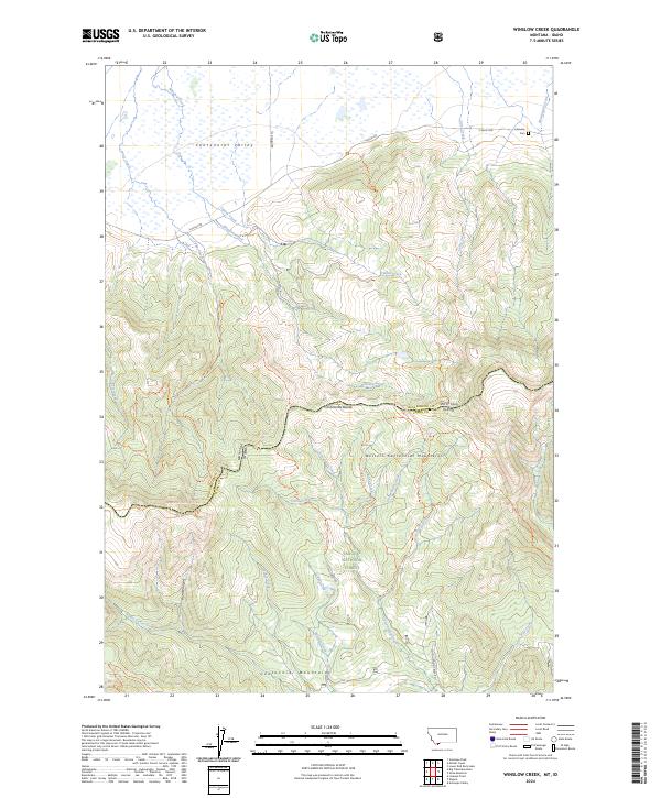
2024 Map of Winslow Creek
USGS Topo · Published 2024About this map
Centennial Valley and the Western Centennial Mountains dominate this 2024 landscape along the Montana-Idaho border. The high-elevation terrain is defined by the Continental Divide, which snakes through the center of the sheet, followed by the Continental Divide National Scenic Trail. In the northern lowlands, the Red Rock Lakes National Wildlife Refuge and Red Rock Lakes Wilderness protect a network of wetlands and creeks, including Winslow Creek and Tipton Creek. Human presence is sparse, marked primarily by the Lakeview Cem and the remote S Valley Rd. To the south, the terrain climbs into the Targhee National Forest, where steep canyons like Burnt Canyon and trails such as the Bear Gulch-Table Mtn Trl indicate a landscape shaped by wilderness and conservation rather than settlement.
Find a feature on this map
44 named features on this map. Tap any name to fly to it.
Don’t see what you’re looking for? This feature index may not catch every label — zoom into the map to look around manually.
Map Details
Editions of this 2024 Winslow Creek Map
This is the sole edition of this map. No revisions or reprints were ever made.
Other maps of this area

1950 · Lower Red Rock Lake
USGS Topo · 1:62,500

1955 · Dubois
USGS Topo · 1:250,000

1955 · Ashton
USGS Topo · 1:250,000

1958 · Dubois
USGS Topo · 1:250,000

1958 · Ashton
USGS Topo · 1:250,000

1960 · Ashton
USGS Topo · 1:250,000

1968 · Big Table Mountain
USGS Topo · 1:24,000

1968 · Antelope Peak
USGS Topo · 1:24,000

1972 · Antelope Valley
USGS Topo · 1:24,000

1972 · Kilgore
USGS Topo · 1:24,000