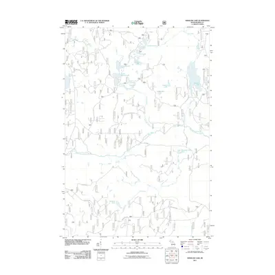
2011 Map of Winslow Lake
USGS Topo · Published 2011About this map
Winslow Lake and a dense network of glacial water bodies define this portion of the Ottawa National Forest region in Michigan's Upper Peninsula. The landscape is interconnected by a complex system of forestry roads, including Federal Forest 3630 Rd and Federal Forest 3500 Rd, which provide access to secluded shorelines at Chamberlain Lake, Poker Lake, and Buddle Lake.
Find a feature on this map
30 named features on this map. Tap any name to fly to it.
Don’t see what you’re looking for? This feature index may not catch every label — zoom into the map to look around manually.
Map Details
Editions of this 2011 Winslow Lake Map
This is the sole edition of this map. No revisions or reprints were ever made.
Other maps of this area

1895 · Perch Lake
USGS Topo · 1:62,500

1898 · Iron River
USGS Topo · 1:62,500

1945 · Gibbs City
USGS Topo · 1:24,000

1946 · Gibbs City
USGS Topo · 1:31,680

1954 · Kenton
USGS Topo · 1:62,500

1954 · Perch Lake
USGS Topo · 1:62,500

1956 · Beechwood
USGS Topo · 1:62,500

1958 · Iron River
USGS Topo · 1:250,000

1960 · Iron River
USGS Topo · 1:250,000

1961 · Iron River
USGS Topo · 1:250,000