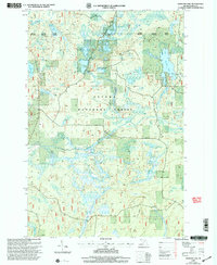
1999 Map of Winslow Lake
USGS Topo · Published 2004About this map
The Ottawa National Forest in the Upper Peninsula’s Iron County is defined by a dense network of glacial lakes and river systems as they appeared at the end of the 20th century. The Paint River and its North Branch Paint River serve as the primary hydrologic arteries, while smaller features like Big Spring Hole and Little Tamarack Lake punctuate the wooded terrain. Human infrastructure is subtly present through water management and industrial remnants, such as Holmes Dam, Dam 10, and a solitary Gravel Pit.
Find a feature on this map
31 named features on this map. Tap any name to fly to it.
Don’t see what you’re looking for? This feature index may not catch every label — zoom into the map to look around manually.
Map Details
Editions of this 1999 Winslow Lake Map
This is the sole edition of this map. No revisions or reprints were ever made.
Other maps of this area

1895 · Perch Lake
USGS Topo · 1:62,500

1898 · Iron River
USGS Topo · 1:62,500

1945 · Gibbs City
USGS Topo · 1:24,000

1946 · Gibbs City
USGS Topo · 1:31,680

1954 · Kenton
USGS Topo · 1:62,500

1954 · Perch Lake
USGS Topo · 1:62,500

1956 · Beechwood
USGS Topo · 1:62,500

1958 · Iron River
USGS Topo · 1:250,000

1960 · Iron River
USGS Topo · 1:250,000

1961 · Iron River
USGS Topo · 1:250,000