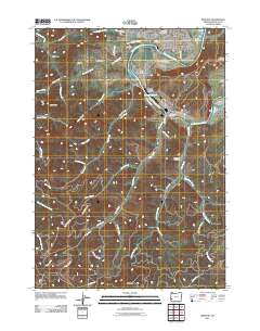
2011 Map of Winston
USGS Topo · Published 2011About this map
The South Umpqua River defines the landscape of this southern Oregon corridor, where the settlements of Winston, Dillard, and Brockway follow the fertile valley floor. This 2011 topographic study captures a region where timber and agriculture remain central to the local economy, evidenced by the Dillard Log Pond and the extensive network of rural routes like Old Brockway Rd and Willis Creek Rd. For those researching family history, the map provides precise locations for the Cox Cemetery, Willis Creek Cemetery, and Civil Bend Cemetery. Notable landmarks such as Mount Obette and the Martha Rice Bridge serve as distinct navigational points between the upland reaches of Big Baldy and the serpentine path of Lookingglass Creek.
Find a feature on this map
54 named features on this map. Tap any name to fly to it.
Don’t see what you’re looking for? This feature index may not catch every label — zoom into the map to look around manually.
Map Details
Editions of this 2011 Winston Map
This is the sole edition of this map. No revisions or reprints were ever made.
Other maps of this area

1897 · Roseburg
USGS Topo · 1:125,000

1900 · Roseburg
USGS Topo · 1:125,000
1904 · Riddle
USGS Topo · 1:125,000
1928 · Sitkum
USGS Topo · 1:125,000
1946 · Dutchman Butte
USGS Topo · 1:62,500
1948 · Dutchman Butte
USGS Topo · 1:62,500
1954 · Canyonville
USGS Topo · 1:62,500
1955 · Camas Valley
USGS Topo · 1:62,500
1955 · Roseburg
USGS Topo · 1:62,500

1955 · Medford
USGS Topo · 1:250,000