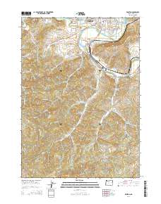
2014 Map of Winston
USGS Topo · Published 2014About this map
The South Umpqua River snakes through this Douglas County landscape, serving as a primary corridor for both rail and road transit between Winston and Dillard. The presence of the Pacific Plywood Corporation and the Alsea Log Pond highlights the importance of the local timber economy, while the Central Oregon & Pacific RR follows the river's path, facilitating industrial transport. Settlement patterns are concentrated along the valley floors near Civil Bend and Brockway, where the terrain transitions from the alluvial plains of Lookingglass Creek to the surrounding peaks.
Find a feature on this map
85 named features on this map. Tap any name to fly to it.
Don’t see what you’re looking for? This feature index may not catch every label — zoom into the map to look around manually.
Map Details
Editions of this 2014 Winston Map
This is the sole edition of this map. No revisions or reprints were ever made.
Other maps of this area

1897 · Roseburg
USGS Topo · 1:125,000

1900 · Roseburg
USGS Topo · 1:125,000

1904 · Riddle
USGS Topo · 1:125,000

1928 · Sitkum
USGS Topo · 1:125,000

1946 · Dutchman Butte
USGS Topo · 1:62,500

1948 · Dutchman Butte
USGS Topo · 1:62,500

1954 · Canyonville
USGS Topo · 1:62,500

1955 · Camas Valley
USGS Topo · 1:62,500

1955 · Roseburg
USGS Topo · 1:62,500

1955 · Medford
USGS Topo · 1:250,000