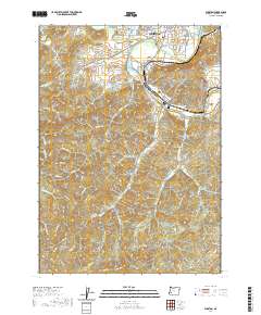
2020 Map of Winston
USGS Topo · Published 2020About this map
Winston and the nearby communities of Dillard and Brockway define the northern valley of this region where the South Umpqua River and Lookingglass Creek converge. The landscape is characterized by a mix of agricultural valley floor and steep timbered ridges, illustrated by the presence of the Dillard Log Pond and numerous timber access routes like Porter Creek Rd. This 2020 record captures the historical footprint of early settlements through sites like the Civil Bend Cem and Cox Cem, which are situated near the old river bends. The map transitions from the residential streets of Winston to the high elevations of Mt Obette and Big Baldy, providing a clear view of how development has navigated the complex terrain of the Umpqua watershed.
Find a feature on this map
87 named features on this map. Tap any name to fly to it.
Don’t see what you’re looking for? This feature index may not catch every label — zoom into the map to look around manually.
Map Details
Editions of this 2020 Winston Map
This is the sole edition of this map. No revisions or reprints were ever made.
Other maps of this area

1897 · Roseburg
USGS Topo · 1:125,000

1900 · Roseburg
USGS Topo · 1:125,000

1904 · Riddle
USGS Topo · 1:125,000

1928 · Sitkum
USGS Topo · 1:125,000

1946 · Dutchman Butte
USGS Topo · 1:62,500

1948 · Dutchman Butte
USGS Topo · 1:62,500

1954 · Canyonville
USGS Topo · 1:62,500

1955 · Camas Valley
USGS Topo · 1:62,500

1955 · Roseburg
USGS Topo · 1:62,500

1955 · Medford
USGS Topo · 1:250,000