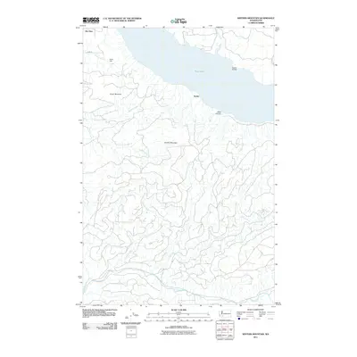
2011 Map of Winters Mountain
USGS Topo · Published 2011About this map
Riffe Lake dominates the northern landscape of this Lewis County region, where the impounded waters of the Cowlitz River meet the infrastructure of Raatz Dam. The settlements of Nesika and Alta Vista serve as the primary human touchpoints in a terrain defined by sharp elevation changes and dense drainage networks. The central topography is anchored by Winters Mountain and Green Mountain, with numerous watercourses like Winston Creek and Thurston Creek carving deep into the timbered slopes. To the south, the Green River snakes through the lower elevations, while the Nesika Bridge provides a vital link across the northern waters. This map captures the late twentieth-century development of the area's logging and water management systems, showing the relationship between established access points like Hagen Rd and the vast network of forest roads reaching into Steel Canyon.
Find a feature on this map
17 named features on this map. Tap any name to fly to it.
Don’t see what you’re looking for? This feature index may not catch every label — zoom into the map to look around manually.
Map Details
Editions of this 2011 Winters Mountain Map
This is the sole edition of this map. No revisions or reprints were ever made.
Other maps of this area

1919 · Mount St Helens
USGS Topo · 1:125,000

1937 · Eatonville
USGS Topo · 1:125,000

1953 · Hoquiam
USGS Topo · 1:250,000

1953 · Elk Rock
USGS Topo · 1:62,500

1956 · Mineral
USGS Topo · 1:62,500

1957 · Hoquiam
USGS Topo · 1:250,000

1957 · Morton
USGS Topo · 1:62,500

1957 · Spirit Lake
USGS Topo · 1:62,500

1958 · Hoquiam
USGS Topo · 1:250,000

1962 · Hoquiam
USGS Topo · 1:250,000