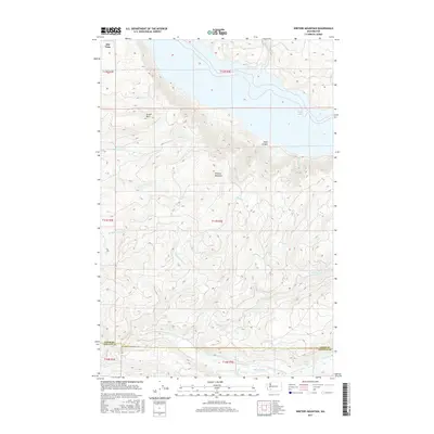
2017 Map of Winters Mountain
USGS Topo · Published 2017About this map
Alta Vista sits at the northwestern edge of a landscape defined by dramatic elevation changes and a dense network of mountain drainage. The terrain is anchored by the central heights of Winters Mountain and Green Mtn, which separate the various branches of the Winston Cr system from the Green River corridor along the southern boundary. To the northeast, the waters of Riffe Lake occupy the lowlands, fed by steep-descending streams like Shelton Cr. This survey illustrates the intricate geography of the region at the border of Lewis and Cowlitz counties, where the high-altitude Soda Spring and the narrow passage of Steel Canyon emphasize the topographical complexity of the Pacific Northwest. The drainage patterns of Thurston Cr and Indian Cr showcase the many tributaries that carve through these southern Washington peaks.
Find a feature on this map
23 named features on this map. Tap any name to fly to it.
Don’t see what you’re looking for? This feature index may not catch every label — zoom into the map to look around manually.
Map Details
Editions of this 2017 Winters Mountain Map
This is the sole edition of this map. No revisions or reprints were ever made.
Other maps of this area

1919 · Mount St Helens
USGS Topo · 1:125,000

1937 · Eatonville
USGS Topo · 1:125,000

1953 · Hoquiam
USGS Topo · 1:250,000

1953 · Elk Rock
USGS Topo · 1:62,500

1956 · Mineral
USGS Topo · 1:62,500

1957 · Hoquiam
USGS Topo · 1:250,000

1957 · Morton
USGS Topo · 1:62,500

1957 · Spirit Lake
USGS Topo · 1:62,500

1958 · Hoquiam
USGS Topo · 1:250,000

1962 · Hoquiam
USGS Topo · 1:250,000