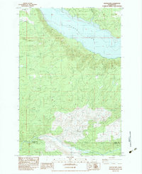
1983 Map of Winters Mtn
USGS Topo · Published 1983About this map
Riffe Lake dominates the northern landscape of this 1980s provisional study, its southern shoreline marked by a 779 dash line subject to inundation. This fluctuating water level reflects the reservoir's role in the regional hydroelectric and flood control system, submerging the former valley floor. To the south, the terrain rises sharply toward Winters Mountain and Green Mountain, where a network of primitive roads and Borrow Pits indicates active timber management and land use. The presence of numerous blowdown labels across the southern slopes, particularly near Elk Creek and Cascade Creek, documents the massive forest disturbance following the 1980 eruption of Mount St. Helens. Further south, the Green River carves through the boundary between Lewis Co and Cowlitz Co, passing landmarks like Soda Spring and a local Quarry.
Find a feature on this map
19 named features on this map. Tap any name to fly to it.
Don’t see what you’re looking for? This feature index may not catch every label — zoom into the map to look around manually.
Map Details
Editions of this 1983 Winters Mtn Map
This is the sole edition of this map. No revisions or reprints were ever made.
Other maps of this area

1919 · Mount St Helens
USGS Topo · 1:125,000

1937 · Eatonville
USGS Topo · 1:125,000

1953 · Hoquiam
USGS Topo · 1:250,000

1953 · Elk Rock
USGS Topo · 1:62,500

1956 · Mineral
USGS Topo · 1:62,500

1957 · Hoquiam
USGS Topo · 1:250,000

1957 · Morton
USGS Topo · 1:62,500

1957 · Spirit Lake
USGS Topo · 1:62,500

1958 · Hoquiam
USGS Topo · 1:250,000

1962 · Hoquiam
USGS Topo · 1:250,000