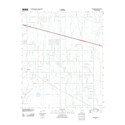
2011 Map of Wintersburg
USGS Topo · Published 2011About this map
The community of Wintersburg sits on the western edge of this Maricopa County landscape, where the desert is defined by an intricate network of drainage systems. Ephemeral waterways like Fourmile Wash, Phillips Wash, and Dickey Wash cut across the arid terrain, eventually leading toward the wide corridor of the Hassayampa River on the eastern margin. The map reveals a strictly gridded road system typical of Arizona's valley development, with major thoroughfares such as W Indian School Rd and W Southern Ave segmenting the land into large undeveloped blocks.
Find a feature on this map
34 named features on this map. Tap any name to fly to it.
Don’t see what you’re looking for? This feature index may not catch every label — zoom into the map to look around manually.
Map Details
Editions of this 2011 Wintersburg Map
This is the sole edition of this map. No revisions or reprints were ever made.
Other maps of this area

1954 · Phoenix
USGS Topo · 1:250,000

1957 · Phoenix
USGS Topo · 1:250,000

1957 · White Tank Mts.
USGS Topo · 1:62,500

1958 · Phoenix
USGS Topo · 1:250,000

1958 · Buckeye NW
USGS Topo · 1:24,000

1958 · Hassayampa
USGS Topo · 1:24,000

1958 · Buckeye
USGS Topo · 1:62,500

1960 · Phoenix
USGS Topo · 1:250,000

1962 · Belmont Mts
USGS Topo · 1:62,500

1962 · Arlington
USGS Topo · 1:62,500