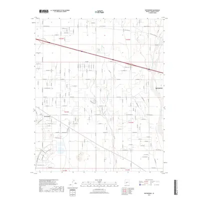
2018 Map of Wintersburg
USGS Topo · Published 2018About this map
Wintersburg sits at the heart of this agricultural and desert landscape, where the rectangular grid of section lines meets the natural drainage systems of the West Valley. The ephemeral Hassayampa River defines the eastern edge of the area, its broad sandy bed flanked by the expanding western limits of Buckeye. Between these two points, a network of irrigation-influenced roads like Buckeye Ranch Rd and W Lower Buckeye Rd crisscross the terrain. The map captures a moment of transition as traditional farm plots and desert washes like Dickey Wash and Phillips Wash coexist with specialized infrastructure, including the various entrances to the Palo Verde site such as W Palo Verde 1 Entr. This pattern of development illustrates the 21st-century evolution of Maricopa County's rural outskirts into a more complex industrial and residential corridor.
Find a feature on this map
55 named features on this map. Tap any name to fly to it.
Don’t see what you’re looking for? This feature index may not catch every label — zoom into the map to look around manually.
Map Details
Editions of this 2018 Wintersburg Map
This is the sole edition of this map. No revisions or reprints were ever made.
Other maps of this area

1954 · Phoenix
USGS Topo · 1:250,000

1957 · Phoenix
USGS Topo · 1:250,000

1957 · White Tank Mts.
USGS Topo · 1:62,500

1958 · Phoenix
USGS Topo · 1:250,000

1958 · Buckeye NW
USGS Topo · 1:24,000

1958 · Hassayampa
USGS Topo · 1:24,000

1958 · Buckeye
USGS Topo · 1:62,500

1960 · Phoenix
USGS Topo · 1:250,000

1962 · Belmont Mts
USGS Topo · 1:62,500

1962 · Arlington
USGS Topo · 1:62,500