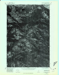
1975 Map of Winterville SW
USGS Topo · Published 1981About this map
Fish River Lake and Carr Pond anchor the southern reaches of this orthophotograph, representing the dense forest and water-dominant landscape of northern Maine in the mid-1970s. The aerial imagery captures the area’s timber-based character, showing the texture of the canopy and the winding path of the Fish River as it cuts across the center of the quadrangle. Elevation is marked by the presence of Ferguson Mountain, while nearby Ferguson Pond sits in the high northern terrain. Unlike standard topographic maps, this aerial perspective reveals the actual density of the woods and the specific patterns of clearing or access trails that supported the region's land use during this period, offering a literal view of the ground cover as it existed on October 9, 1975.
Find a feature on this map
5 named features on this map. Tap any name to fly to it.
Don’t see what you’re looking for? This feature index may not catch every label — zoom into the map to look around manually.
Map Details
Editions of this 1975 Winterville SW Map
This is the sole edition of this map. No revisions or reprints were ever made.
Other maps of this area

1928 · Winterville
USGS Topo · 1:48,000

1930 · Greenlaw
USGS Topo · 1:48,000

1931 · Fish River Lake
USGS Topo · 1:48,000

1931 · Mooseleuk Lake
USGS Topo · 1:48,000

1931 · Winterville
USGS Topo · 1:62,500

1933 · Greenlaw
USGS Topo · 1:62,500

1935 · Fish River Lake
USGS Topo · 1:62,500

1935 · Mooseleuk Lake
USGS Topo · 1:62,500

1954 · Presque Isle
USGS Topo · 1:250,000

1958 · Presque Isle
USGS Topo · 1:250,000