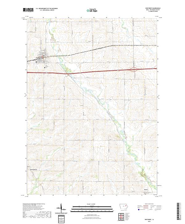
2022 Map of Winthrop
USGS Topo · Published 2022About this map
Winthrop serves as the primary hub in this portion of Buchanan County, situated along a grid of agricultural section roads and the East-West thoroughfare of 220th St. The landscape is dominated by the meandering course of Buffalo Creek, which bisects the quadrangle as it flows toward the community of Quasqueton in the southwest corner. This drainage system, including Nash Cr and Smith Cr, dictates the placement of early settlements and rural cemeteries that anchor the local genealogy. Near Winthrop, Fairview Cem and Saint Patricks Cem provide key markers for family history, while the small cluster at Monti in the southeast corner marks another quiet crossroads. The map illustrates a mature agricultural economy, where the township boundaries like t88n r8w enclose a territory defined by steady drainage and long-established farmstead access.
Find a feature on this map
64 named features on this map. Tap any name to fly to it.
Don’t see what you’re looking for? This feature index may not catch every label — zoom into the map to look around manually.
Map Details
Editions of this 2022 Winthrop Map
This is the sole edition of this map. No revisions or reprints were ever made.
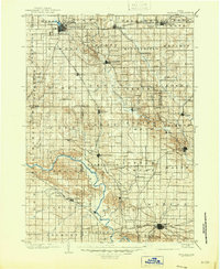
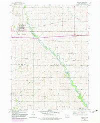
Historical Maps of Quasqueton Through Time
3 maps found