
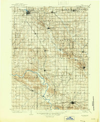
1903 Map of Winthrop
USGS Topo · Published 1903About this map
The Wapsipinicon River and Cedar River carve distinct drainage patterns across this East Central Iowa landscape at the opening of the twentieth century. Several prominent rail corridors define the region's connectivity, including the Illinois Central through Independence and the Burlington Cedar Rapids and Northern cutting diagonally past Center Point. These steel arteries linked growing agricultural hubs such as Winthrop, Coggon, and Marion, which already shows a dense street grid. Smaller hamlets and rural post offices like Quasqueton, Troy Mills, and Alice are nestled along the river bends, reflecting a era of localized commerce before the consolidation of rural communities. The map captures a high degree of topographic detail along the river bluffs, contrasting the meandering watercourses with the rigid township boundaries of Fremont and Coffins Grove.
Find a feature on this map
86 named features on this map. Tap any name to fly to it.
Don’t see what you’re looking for? This feature index may not catch every label — zoom into the map to look around manually.
Map Details
Editions of this 1903 Winthrop Map
2 editions found
Other maps of this area

1887 · Cedar Rapids
USGS Topo · 1:62,500

1888 · Shellsburg
USGS Topo · 1:62,500

1888 · Marion
USGS Topo · 1:62,500

1888 · Amana
USGS Topo · 1:62,500

1889 · Marion
USGS Topo · 1:62,500

1889 · Amana
USGS Topo · 1:62,500

1889 · Shellsburg
USGS Topo · 1:62,500

1890 · Anamosa
USGS Topo · 1:62,500

1891 · Mechanicsville
USGS Topo · 1:62,500

1891 · Cedar Rapids
USGS Topo · 1:62,500