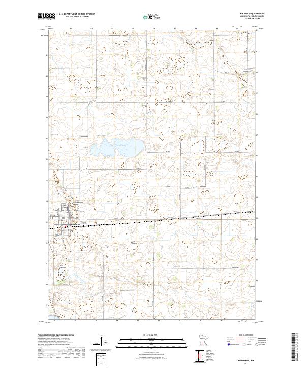
2022 Map of Winthrop
USGS Topo · Published 2022About this map
Winthrop serves as the primary center of activity in this Sibley County landscape, where a dense grid of local streets like Main St N and Hennepin St N meets industrial development along Industrial Dr. The surrounding prairie terrain is defined by a significant drainage network and several distinct basins, including Indian Lake and the expansive Marsh Lakebed. These features, along with Allen Lakebed and Mud Lakebed, suggest a history of fluctuating water levels and land reclamation common in this part of Minnesota. The rural portions of the quadrangle are strictly organized by a section-line road system, featuring routes such as Co Hwy 10 and Township Rd. Genealogical interest is anchored by the Saint John's Lutheran Cem located in the northeastern corner, while the Middle Br Rush River provides the primary natural drainage for the southern fields.
Find a feature on this map
36 named features on this map. Tap any name to fly to it.
Don’t see what you’re looking for? This feature index may not catch every label — zoom into the map to look around manually.
Map Details
Editions of this 2022 Winthrop Map
This is the sole edition of this map. No revisions or reprints were ever made.
Other maps of this area

1953 · New Ulm
USGS Topo · 1:250,000

1957 · New Ulm
USGS Topo · 1:250,000

1958 · New Ulm
USGS Topo · 1:250,000

1958 · Gaylord
USGS Topo · 1:62,500

1958 · Winthrop
USGS Topo · 1:62,500

1964 · Bernadotte
USGS Topo · 1:24,000

1964 · Lafayette
USGS Topo · 1:24,000

1965 · New Sweden
USGS Topo · 1:24,000

1967 · New Ulm
USGS Topo · 1:250,000
1982 · Winthrop SW
USGS Topo · 1:24,000