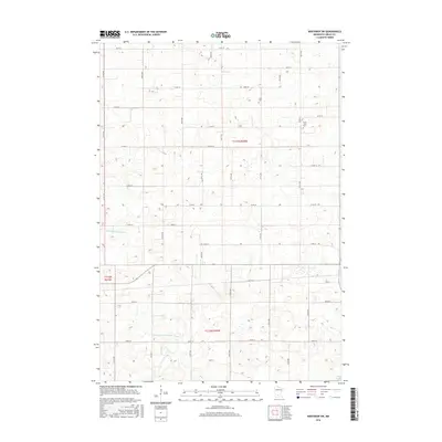
2016 Map of Winthrop SW
USGS Topo · Published 2016About this map
The agricultural landscape of Sibley County is defined by a grid of rural routes and vital water management systems, including the Middle Br Rush River and County Ditch Number Thirteen. This portion of the Minnesota prairie reveals a settlement pattern anchored by small community landmarks, such as Tabor Cem and Saint John's Cem, which serve as quiet touchpoints for local family history. The terrain is characterized by subtle elevation changes and numerous depressions, with the southern edge of the quadrangle reaching toward the shoreline of Sand Lake. The extensive network of township roads, including Co HWY 10 and 270th ST, illustrates the enduring structure of the Public Land Survey System that has organized this region since the mid-19th century.
Find a feature on this map
38 named features on this map. Tap any name to fly to it.
Don’t see what you’re looking for? This feature index may not catch every label — zoom into the map to look around manually.
Map Details
Editions of this 2016 Winthrop SW Map
This is the sole edition of this map. No revisions or reprints were ever made.
Other maps of this area

1953 · New Ulm
USGS Topo · 1:250,000

1957 · New Ulm
USGS Topo · 1:250,000

1958 · New Ulm
USGS Topo · 1:250,000

1958 · Winthrop
USGS Topo · 1:62,500

1964 · Bernadotte
USGS Topo · 1:24,000

1964 · Buffalo Lake
USGS Topo · 1:24,000

1964 · Lafayette
USGS Topo · 1:24,000

1964 · St George
USGS Topo · 1:24,000

1964 · Gibbon
USGS Topo · 1:24,000

1967 · New Ulm
USGS Topo · 1:250,000