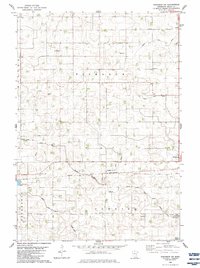
1982 Map of Winthrop SW
USGS Topo · Published 1983About this map
The Middle Branch Rush River meanders through the townships of Bismarck, Cornish, and Severance in this early 1980s agricultural survey. The landscape is defined by an extensive network of drainage systems, including Ditch No 18 and Ditch No 42, which demonstrate the intensive modification of the Sibley County terrain for prairie farming. The city of Winthrop anchors the eastern edge of the map, where the Chicago And North Western railroad tracks cut through the countryside.
Find a feature on this map
27 named features on this map. Tap any name to fly to it.
Don’t see what you’re looking for? This feature index may not catch every label — zoom into the map to look around manually.
Map Details
Editions of this 1982 Winthrop SW Map
This is the sole edition of this map. No revisions or reprints were ever made.
Other maps of this area

1953 · New Ulm
USGS Topo · 1:250,000

1957 · New Ulm
USGS Topo · 1:250,000

1958 · New Ulm
USGS Topo · 1:250,000

1958 · Winthrop
USGS Topo · 1:62,500

1964 · Bernadotte
USGS Topo · 1:24,000

1964 · Buffalo Lake
USGS Topo · 1:24,000

1964 · Lafayette
USGS Topo · 1:24,000

1964 · St George
USGS Topo · 1:24,000

1964 · Gibbon
USGS Topo · 1:24,000

1967 · New Ulm
USGS Topo · 1:250,000