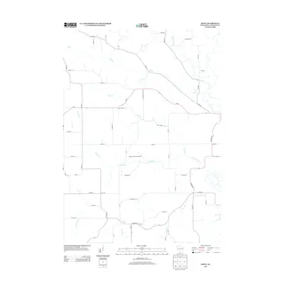
2013 Map of Wiota
USGS Topo · Published 2013About this map
Whoopy Hollow Aerodrome sits near the center of this rural landscape in Lafayette County, marking a distinct aviation point amidst the agricultural patterns of the early twenty-first century. The terrain is defined by a dense network of tributaries, including Apple Br, Whiteside Creek, and Mud Br, which carve through the countryside toward the Yellowstone River in the northeast. This water-rich environment is tied together by a web of local routes like Apple Grove Church Rd and Apple Branch Rd, reflecting a long-standing settlement pattern where transport often followed the logic of the creeks.
Find a feature on this map
51 named features on this map. Tap any name to fly to it.
Don’t see what you’re looking for? This feature index may not catch every label — zoom into the map to look around manually.
Map Details
Editions of this 2013 Wiota Map
This is the sole edition of this map. No revisions or reprints were ever made.
Other maps of this area

1902 · Mineral Point
USGS Topo · 1:125,000

1923 · Blanchardville
USGS Topo · 1:62,500

1923 · South Wayne
USGS Topo · 1:62,500

1954 · Rockford
USGS Topo · 1:250,000

1955 · Rockford
USGS Topo · 1:250,000

1958 · Rockford
USGS Topo · 1:250,000

1959 · Dubuque
USGS Topo · 1:250,000

1961 · Dubuque
USGS Topo · 1:250,000

1962 · Dubuque
USGS Topo · 1:250,000
1962 · Blanchardville
USGS Topo · 1:62,500