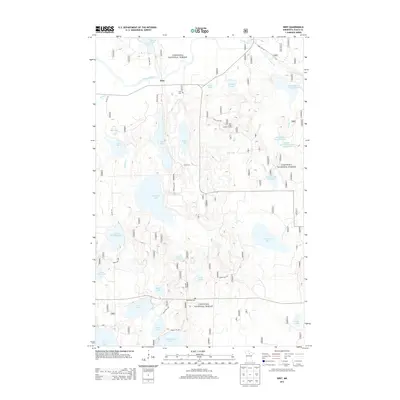
2013 Map of Wirt
USGS Topo · Published 2013About this map
The settlement of Wirt serves as the focal point for this 2013 survey of north-central Minnesota, where the Big Fork River winds through the densely forested and water-rich landscape of the Chippewa National Forest. The map documents a complex system of hydrology and conservation, featuring numerous reservoirs and impoundments such as the Beaver Lodge Reservoir and Fletcher Creek Impoundment Reservoir. Local history is anchored by the Wirt Cem and Sand Lake Cem, while the Bass Lake Lookout Tower stands as a prominent landmark for forestry operations. The terrain is defined by an intricate network of timber and forest service roads, including Old Wirt Rd and Co Hwy 29, which provide access to a high density of named water bodies like Whitefish Lake, Stone Axe Lake, and Rush Island Lake.
Find a feature on this map
44 named features on this map. Tap any name to fly to it.
Don’t see what you’re looking for? This feature index may not catch every label — zoom into the map to look around manually.
Map Details
Editions of this 2013 Wirt Map
This is the sole edition of this map. No revisions or reprints were ever made.
Other maps of this area

1918 · Zora
USGS Topo · 1:62,500

1919 · Zora
USGS Topo · 1:62,500

1919 · Gemmell
USGS Topo · 1:62,500

1919 · Max
USGS Topo · 1:62,500

1954 · Bemidji
USGS Topo · 1:250,000

1954 · Hibbing
USGS Topo · 1:250,000

1957 · Bemidji
USGS Topo · 1:250,000

1957 · Hibbing
USGS Topo · 1:250,000

1958 · Bemidji
USGS Topo · 1:250,000

1958 · Hibbing
USGS Topo · 1:250,000