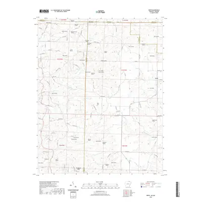
2020 Map of Wirth
USGS Topo · Published 2020About this map
Wirth and Woodland Hills anchor this survey of the Ozark foothills along the Arkansas and Missouri border. The landscape is defined by a dense network of named drainage basins and springs, including Ruprecht Spring and Ellis Spring, which feed into major waterways like Moccasin Cr and Forty Island Cr. The intricate topography is recorded through dozens of family-named hollows, such as Tuttwaller Hollow and Zirnstein Hollow, reflecting generations of settlement and land use in this borderland. Local history is deeply embedded in the terrain at sites like Mine Hollow and Sawmill Hollow, suggesting early industrial activity. For genealogists, the map is particularly valuable for its precise location of small family and community burial grounds, including the Babe Collins Cem, Ed Collins Cem, Bethel Cem, and Flint Cem.
Find a feature on this map
129 named features on this map. Tap any name to fly to it.
Don’t see what you’re looking for? This feature index may not catch every label — zoom into the map to look around manually.
Map Details
Editions of this 2020 Wirth Map
This is the sole edition of this map. No revisions or reprints were ever made.
Other maps of this area

1943 · Thayer
USGS Topo · 1:62,500

1944 · Couch
USGS Topo · 1:62,500

1946 · Thayer
USGS Topo · 1:62,500

1946 · Couch
USGS Topo · 1:62,500

1957 · Poplar Bluff
USGS Topo · 1:250,000

1959 · Poplar Bluff
USGS Topo · 1:250,000

1960 · Poplar Bluff
USGS Topo · 1:250,000

1962 · Stuart
USGS Topo · 1:24,000

1962 · Mammoth Spring
USGS Topo · 1:24,000

1968 · Hardy
USGS Topo · 1:24,000