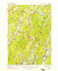
1944 Map of Wiscasset
USGS Topo · Published 1948About this map
The Sheepscot River and Dyer River dominate the interior landscape of this mid-century survey, creating a network of interconnected waterways including Clary Lake, Long Pond, and Deer Meadow Pond. The region's transport and industrial legacy is visible in the corridor of the Maine Central Railroad, which serves settlements like South Newcastle Sta and Wiscasset. The settlement pattern reflects a deeply rooted rural community, marked by a high density of local institutions such as Whitefield Memorial Hospital, the Fair Grounds near Damariscotta, and the Health and Welfare Camp on Dyer Long Pond.
Find a feature on this map
129 named features on this map. Tap any name to fly to it.
Don’t see what you’re looking for? This feature index may not catch every label — zoom into the map to look around manually.
Map Details
Editions of this 1944 Wiscasset Map
4 editions found

Other maps of this area

1892 · Gardiner
USGS Topo · 1:62,500

1892 · Augusta
USGS Topo · 1:62,500

1893 · Vassalboro
USGS Topo · 1:62,500

1893 · Wiscasset
USGS Topo · 1:62,500

1893 · Boothbay
USGS Topo · 1:62,500

1894 · Bath
USGS Topo · 1:62,500

1898 · Vassalboro
USGS Topo · 1:62,500

1904 · Monhegan
USGS Topo · 1:62,500

1906 · Monhegan
USGS Topo · 1:62,500

1913 · Waldoboro
USGS Topo · 1:48,000