1990 Map of Wisconsin Dells
USGS Topo · Published 1991About this map
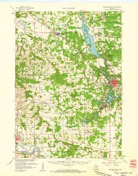
The Wisconsin River carves through the heart of this landscape, anchoring a complex network of waterways including the massive Castle Rock Lake and the glacially-formed Green Lake. This 1990 revision, compiled from earlier surveys, shows the region during a period of established recreation and conservation. Numerous protected areas like Roche A Cri State Park and the Grand River State Wildlife Area flank the river valleys, while prominent landmarks such as Houghton Rock and Lighthouse Rock stand out against the terrain.
Find a feature on this map
75 named features on this map. Tap any name to fly to it.
Don’t see what you’re looking for? This feature index may not catch every label — zoom into the map to look around manually.
Map Details
Editions of this 1990 Wisconsin Dells Map
This is the sole edition of this map. No revisions or reprints were ever made.
Historical Maps of Portage Through Time
3 maps found