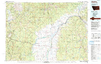
1994 Map of Wisdom
USGS Topo · Published 1994About this map
Big Hole National Battlefield Nez Perce National Historical Park occupies a central position on this landscape, marking a site of significant cultural and historical weight where the Big Hole River winds through the valley. The map documents a complex intersection of national forests, including the Beaverhead, Deerlodge, Bitterroot, and Salmon National Forests, all converging near the Continental Divide.
Find a feature on this map
49 named features on this map. Tap any name to fly to it.
Don’t see what you’re looking for? This feature index may not catch every label — zoom into the map to look around manually.
Map Details
Editions of this 1994 Wisdom Map
2 editions found
Other maps of this area

1889 · Helena
USGS Topo · 1:250,000

1893 · Helena
USGS Topo · 1:250,000

1893 · Dillon
USGS Topo · 1:250,000

1899 · Helena
USGS Topo · 1:250,000

1901 · Hamilton
USGS Topo · 1:125,000

1903 · Helena
USGS Topo · 1:250,000

1908 · Philipsburg
USGS Topo · 1:125,000

1909 · Sapphire
USGS Topo · 1:125,000

1947 · Butte
USGS Topo · 1:250,000

1952 · Torrey Mountain
USGS Topo · 1:24,000