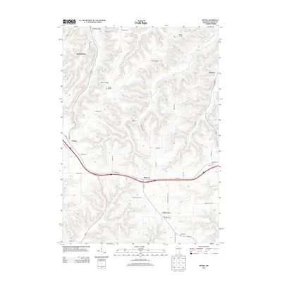
2013 Map of Witoka
USGS Topo · Published 2013About this map
The ridge-and-valley landscape of Winona County is documented here during the early 21st century, centered on the community of Witoka. The terrain is characterized by dramatic elevation changes, with named uplands like Pleasant Ridge and Homer Ridge overlooking deep-set valleys such as Homer Valley, Decker Valley, and Campbell Valley. This topography dictates the settlement patterns and road networks, forcing transportation along the high spines or through the drainage basins of Cedar Cr, Big Trout Cr, and Pine Cr.
Find a feature on this map
51 named features on this map. Tap any name to fly to it.
Don’t see what you’re looking for? This feature index may not catch every label — zoom into the map to look around manually.
Map Details
Editions of this 2013 Witoka Map
This is the sole edition of this map. No revisions or reprints were ever made.
Other maps of this area

1929 · Fountain City
USGS Topo · 1:62,500

1929 · Galesville
USGS Topo · 1:62,500

1930 · La Crescent
USGS Topo · 1:62,500

1934 · Winona
USGS Topo · 1:62,500

1937 · Winona
USGS Topo · 1:62,500

1953 · Eau Claire
USGS Topo · 1:250,000

1956 · La Crescent
USGS Topo · 1:62,500

1958 · Eau Claire
USGS Topo · 1:250,000

1958 · Houston
USGS Topo · 1:62,500

1958 · La Crosse
USGS Topo · 1:250,000