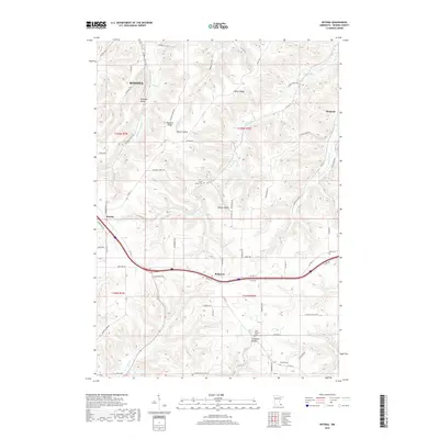
2019 Map of Witoka
USGS Topo · Published 2019About this map
Homer Ridge and the surrounding coulees south of Winona define this portion of the driftless region, where steep valleys break away from the upland plateaus. Small agricultural communities such as Ridgeway and Witoka are positioned along the primary ridge-top routes, while the landscape below is carved by Big Trout Cr and Pleasant Valley Cr. This 2019 survey documents the enduring layout of rural Winona County, showing how modern county highways follow the natural contours of the land. Local history and genealogy are well-represented by several burial sites, including Saint Patricks Cem and Cedar Valley Cem, which sit alongside the drainages of Campbell Valley and Homer Valley. The map illustrates a transition from the higher elevations of Pleasant Ridge toward the smaller settlements like Pickwick tucked near the valley floors.
Find a feature on this map
71 named features on this map. Tap any name to fly to it.
Don’t see what you’re looking for? This feature index may not catch every label — zoom into the map to look around manually.
Map Details
Editions of this 2019 Witoka Map
This is the sole edition of this map. No revisions or reprints were ever made.
Other maps of this area

1929 · Fountain City
USGS Topo · 1:62,500

1929 · Galesville
USGS Topo · 1:62,500

1930 · La Crescent
USGS Topo · 1:62,500

1934 · Winona
USGS Topo · 1:62,500

1937 · Winona
USGS Topo · 1:62,500

1953 · Eau Claire
USGS Topo · 1:250,000

1956 · La Crescent
USGS Topo · 1:62,500

1958 · Eau Claire
USGS Topo · 1:250,000

1958 · Houston
USGS Topo · 1:62,500

1958 · La Crosse
USGS Topo · 1:250,000