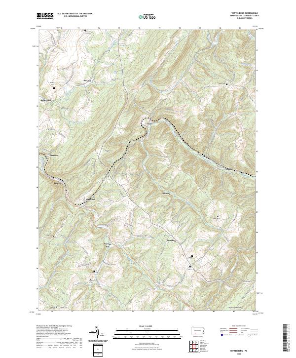
2023 Map of Wittenberg
USGS Topo · Published 2023About this map
Hays Mill and Berkleys Mill anchor the rural landscape of Somerset County, where the terrain is defined by the steep slopes of Big Savage Mountain and the winding course of Wills Creek. This 2023 survey illustrates a region shaped by early industry and agriculture, evidenced by numerous family-named landmarks and small-scale settlements like Sand Patch and Mance. The CSX Transportation line carves through the mountains, following the natural contours of the land alongside water bodies such as Blue Lick Creek. For those tracing local lineages, the map is remarkably dense with burial grounds, including the Klingaman Cem, Hochstetler Cem, and the Mount Zion - Hays Cem. The persistence of these named sites suggests a deeply rooted community that continues to maintain its historical identity within the complex topography of the Alleghenies.
Find a feature on this map
96 named features on this map. Tap any name to fly to it.
Don’t see what you’re looking for? This feature index may not catch every label — zoom into the map to look around manually.
Map Details
Editions of this 2023 Wittenberg Map
This is the sole edition of this map. No revisions or reprints were ever made.
Other maps of this area

1898 · Frostburg
USGS Topo · 1:62,500

1899 · Grantsville
USGS Topo · 1:62,500

1901 · Frostburg
USGS Topo · 1:62,500

1904 · Grantsville
USGS Topo · 1:62,500

1908 · Frostburg
USGS Topo · 1:62,500

1921 · Meyersdale
USGS Topo · 1:62,500

1923 · Berlin
USGS Topo · 1:48,000

1929 · Berlin
USGS Topo · 1:62,500

1939 · Meyersdale
USGS Topo · 1:62,500

1944 · Berlin
USGS Topo · 1:62,500
Featured Places
- Callimont, PA
- Southampton Township, PA
- Northampton Township, PA
- Brothersvalley Township, PA
- Summit Township, PA