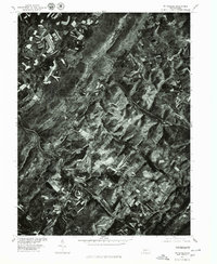
1977 Map of Wittenburg
USGS Topo · Published 1979About this map
Wittenberg and the surrounding Somerset County highlands appear in high contrast in this late-1970s orthophotomap. The imagery reveals a landscape defined by contour farming and strip cropping, where light-toned agricultural ribbons follow the natural curvature of the ridges. This pattern of land use, managed in cooperation with the Soil Conservation Service, highlights the era's focus on erosion control in the Appalachian foothills. The small settlement of Philson and the village of Wittenberg are visible as modest clusters amidst this mosaic of private woodlots and tilled fields. Deeply incised valleys, particularly those carved by Wills Creek, dictate the movement of roads and rail lines through the terrain, illustrating how the physical geography of southern Pennsylvania continued to shape rural settlement and transportation late into the twentieth century.
Find a feature on this map
3 named features on this map. Tap any name to fly to it.
Don’t see what you’re looking for? This feature index may not catch every label — zoom into the map to look around manually.
Map Details
Editions of this 1977 Wittenburg Map
This is the sole edition of this map. No revisions or reprints were ever made.
Other maps of this area

1898 · Frostburg
USGS Topo · 1:62,500

1899 · Grantsville
USGS Topo · 1:62,500

1901 · Frostburg
USGS Topo · 1:62,500

1904 · Grantsville
USGS Topo · 1:62,500

1908 · Frostburg
USGS Topo · 1:62,500

1921 · Meyersdale
USGS Topo · 1:62,500

1923 · Berlin
USGS Topo · 1:48,000

1929 · Berlin
USGS Topo · 1:62,500

1939 · Meyersdale
USGS Topo · 1:62,500

1944 · Berlin
USGS Topo · 1:62,500
Featured Places
- Callimont, PA
- Southampton Township, PA
- Warrens Mill, Greenville Township
- Hays Mill, Brothersvalley Township
- Brothersvalley Township, PA