
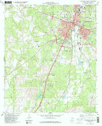
2013 Map of Woden
USGS Topo · Published 2013About this map
Bayou Carrizo and its many tributaries, including White Oak Br and Eggnog Br, dominate the landscape of this East Texas terrain. The settlement pattern consists of small, scattered communities like Woden, Lacyville, and Oak Ridge, connected by a web of county roads and farm-to-market routes. The presence of Fellowview Cem, Moroney Cem, and King Cem provides important anchors for genealogical research in this part of Nacogdoches County.
Find a feature on this map
70 named features on this map. Tap any name to fly to it.
Don’t see what you’re looking for? This feature index may not catch every label — zoom into the map to look around manually.
Map Details
Editions of this 2013 Woden Map
This is the sole edition of this map. No revisions or reprints were ever made.
Other maps of this area

1949 · Lufkin
USGS Topo · 1:62,500

1949 · Platt
USGS Topo · 1:24,000

1950 · Platt
USGS Topo · 1:24,000

1950 · Redland
USGS Topo · 1:24,000

1952 · Nacogdoches
USGS Topo · 1:62,500

1953 · Palestine
USGS Topo · 1:250,000

1957 · Palestine
USGS Topo · 1:250,000

1958 · Broaddus
USGS Topo · 1:62,500

1958 · Martinsville
USGS Topo · 1:62,500
1983 · Nacogdoches South
USGS Topo · 1:24,000