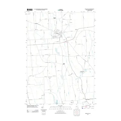
2013 Map of Wolcott
USGS Topo · Published 2013About this map
Wolcott serves as the primary hub of this northern Wayne County landscape, where the confluence of Wolcott Cr and local commerce defines the settlement pattern. The village is surrounded by several historical hamlets and clusters, including Hickory Square, Rice Mill, and Furnace Village, each suggesting the agricultural and early industrial roots of the region. Local genealogy is well-represented through numerous burial grounds such as Glen Side Cem and Huron Evergreen Cem, which anchor the rural roads connecting the community. To the south, the terrain shifts toward Butler Center and South Butler, where the landscape is marked by the Millpond and expansive drainage systems of Black Cr and Butler Cr. This survey documents a resilient rural structure where legacy farms like the Batz Tree Farm continue to operate alongside established residential centers, maintaining the historic road network of the Lake Ontario lowlands.
Find a feature on this map
113 named features on this map. Tap any name to fly to it.
Don’t see what you’re looking for? This feature index may not catch every label — zoom into the map to look around manually.
Map Details
Editions of this 2013 Wolcott Map
This is the sole edition of this map. No revisions or reprints were ever made.
Other maps of this area

1900 · Oswego
USGS Topo · 1:62,500

1902 · Sodus Bay
USGS Topo · 1:62,500

1902 · Clyde
USGS Topo · 1:62,500

1902 · Weedsport
USGS Topo · 1:62,500

1943 · Lyons
USGS Topo · 1:31,680

1943 · Montezuma
USGS Topo · 1:31,680

1943 · Sodus Point
USGS Topo · 1:31,680

1943 · Savannah
USGS Topo · 1:31,680

1943 · Fair Haven
USGS Topo · 1:31,680

1943 · Wolcott
USGS Topo · 1:31,680