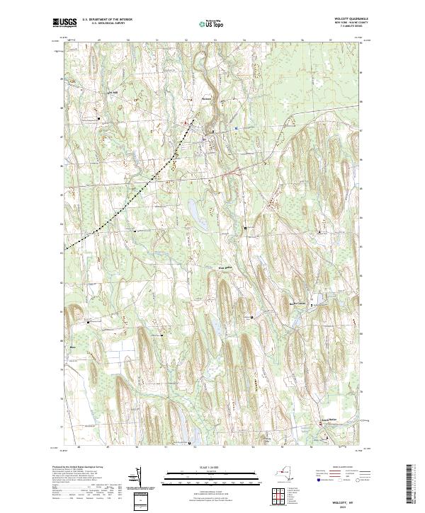
2023 Map of Wolcott
USGS Topo · Published 2023About this map
Wolcott serves as the primary hub in this portion of Wayne County, where a network of local roads like Old Ridge Rd and Auburn St converge near the Glenside Cem. The landscape is defined by the north-south orientation of glacial drumlins and the watercourses that thread between them, including Wolcott Creek and Mudge Creek. Small agricultural hamlets such as West Butler and Butler Center maintain their distinct footprints, often marked by local burial grounds like the Butler Center Cem and Hubbard Cem. To the south, the terrain shifts near South Butler, where Butler Creek feeds into the ecologically distinct Tamarack Swamp. The map also preserves the locations of early industry and landmarks, from the Rice Mill in the northwest to the prominent heights of Whiskey Hill and Pinkney Hill.
Find a feature on this map
99 named features on this map. Tap any name to fly to it.
Don’t see what you’re looking for? This feature index may not catch every label — zoom into the map to look around manually.
Map Details
Editions of this 2023 Wolcott Map
This is the sole edition of this map. No revisions or reprints were ever made.
Other maps of this area

1900 · Oswego
USGS Topo · 1:62,500

1902 · Sodus Bay
USGS Topo · 1:62,500

1902 · Clyde
USGS Topo · 1:62,500

1902 · Weedsport
USGS Topo · 1:62,500

1943 · Lyons
USGS Topo · 1:31,680

1943 · Montezuma
USGS Topo · 1:31,680

1943 · Sodus Point
USGS Topo · 1:31,680

1943 · Savannah
USGS Topo · 1:31,680

1943 · Fair Haven
USGS Topo · 1:31,680

1943 · Wolcott
USGS Topo · 1:31,680